Sorry for the delay on posting a new mystery pic. Particular apologies to my buddy Shmilty (Milton) who has been itching to find out if he guessed right last time around. Well, only my two classmates who responded – Benny and Orah – got the answer 100% correct. But as I mentioned, it was the type of thing that people might guess on their own, but probably would only know for sure if they had ever been there (such as my classmates).
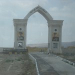
In terms of guessing though, everyone else used some good deductive reasoning. Ilana, Asher, Nechama and Shmilty all recognized the portraits of the father and son Hashemite kings of Jordan, Hussein and Abdullah. So they all guessed that the picture was of one of the border crossings across the Jordan River.
Well, it is technically a border crossing (and since the picture was taken from the Israel side, that’s why it is still an “Israel Mystery Photo,” Benny). But it is actually not a regular border crossing, but something a bit more exceptional.

The “Island of Peace” is a unique spot straddling the border between Israel and Jordan, conceived to promote the noble concept of peace. Physically speaking, the island was created artificially in 1932, when Pinchas Rutenberg built Palestine’s first hydroelectric power plant. It was situated at the confluence of two rivers, the Jordan and the Yarmuk, and was thus named Naharayim, which means “two rivers.”
In order to create enough vertical drop for the water to gain enough force to turn the power turbines, Rutenberg devised a system of dams that created an artificial lake. Part of this process meant creating this island.
Though the majority of the power the plant generated went to the land of Israel, the plant itself had to be located on Jordanian land. (Jordan had been separated from the rest of British Mandate Palestine as a separate country in 1921.) This was because it needed to be located on higher ground so that the power of the water’s drop would be enough. Rutenberg went to King Abdullah in 1921 and requested permission to build it there. He described the honor that Abdullah would receive, being the first in the region to have this type of power plant. The Jordanian king mulled it over for six years before giving his permission.
Of course, Abdullah did not do it for the pure honor. The plant also supplied electricity to two different Jordanian cities in addition to its power to Jews in Palestine. A fair deal, I’d say!
The power plant took 3000 workers 5 years to build, and by the end it supplied power to 90% of the Jews in Palestine. It generated 18 megawatts per day; as a frame of reference, Israelis today use about 10,000 mw/day. But at the time it was sufficient as a start. Quickly, however, the country’s power needs increased and the Naharayim plant’s share of used power rapidly decreased.
With the 1948 war, Israel’s war for independence, the plant ceased operation for good. That was essentially the area’s status until the Israel-Jordan Peace Treaty of 1994. As part of that treaty, the land that is now the Island of Peace was returned to Jordanian sovereignty. Trying to embody the spirit of peace, the land is still farmed by Israeli kibbutzniks, and they pay Jordan a nominal fee for the use of the land. At the same time, Jordan maintains a small military and visual presence on the island. Tourists from Israel need no special visa or passport stamp to reach the island.
The island is an appropriate spot for a statement in support of peace. In addition to the shared usage and its situation on the border, it was also a spot that saw an early attempt at peace between the two countries (albeit a sadly failed attempt). Before the Arab countries that surround Israel attacked in 1948, Golda Meir met secretly with King Abdullah I a few times. The backdrop for these meetings was Naharayim, the town that was built originally as a workers’ village for the power plant. These meetings were attempts to convince Jordan to remain neutral in that war, but alas the attempts failed. Still, as a tribute to the attempts, the choice of this spot as the Island of Peace is a nice one.
Unfortunately, this optimistic story also features a very sad chapter. Just a few short years after the Israel-Jordan Peace Treaty, a Jordanian soldier who was on guard at the Island of Peace opened fire on a busload of seventh and eighth grade school girls from Bet Shemesh, Israel. The 80 girls were on a class trip, and the killer, Ahmed Daqamseh killed seven girls and injured a teacher and five more girls. His M-16 then jammed and other Jordanian soldiers subdued him.
The Jordanian army officially announced that Daqamseh was mentally ill. Unfortunately, this same justification has been used subsequently at other times for other such terrorist attacks. Daqamseh later sat trial in Jordan and received a life sentence.
On of the positives that followed the aftermath of the horrific attack was the honorable response of Jordan’s King Hussein. He came to Israel, and visited the shiva houses (houses of mourning) of the seven bereaved families. He also visited the injured in the hospital and expressed sincere shame and condolences. This type of act of dignified humanity is all too rare in the history of the Arab-Israeli Conflict, and was welcomed with open arms by most Israelis.

Disracted my the delicious looking meats in your new head banner
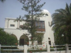
it looks like it could be a house in Hertzilia Pituach (although I’m sure its not)
Oh, the picture on the header just changed! now my previous comment looks silly hahahaha – still dont know where the new pic is though and wondering if Shmilty was indeed right?!
Shmilty hasn’t responded to this one yet, just the previous post! 🙂
Sorry about that! Forgot to enable comment moderation on this post. All future responses will be held in hidden queue until I post the next Mystery Photo!
Very interesting, have never been on the Island of Peace but passed it numerous times on the way to hiking trips. Have no idea what the mystery photo is! Will stay tuned
Wellsir, I thought that was in TLV somewhere, and peeking at the exif data on your JPEG confirmed it, you snapped that photo on the same day that we toured Tel Aviv with Nili Perri (ok, I cheated, but only a little 😉 )
That wooden box is called Mashrabiya. Arab ladies would sit in there and sip lemonade, watching the crowds pass by.
Do you remember the name of the clay tubes built into the roof-wall (see Northern Ramparts Walk)?
This beautiful house, built in the eclectic stlye, was once home to Chayam Nachman Bilalik, Israel’s national poet. Today it is a meuseum